Northernmost district · Phayao
Where the waterfall is still warm Phu Sang
A 35°C stream rising from under the forest, a border crossing at the end of the road, and a ridge full of stars — all in one district you can drive around in a single day.
Close to dusk — if you head onto a trail, leave time to get out before dark
01 — About Phu Sang
The smallest district by size
the largest by variety
Phu Sang split from Chiang Kham as a minor district on 26 June 1996 and became a full district on 24 August 2007. It covers 199.37 km² across 5 sub-districts and 59 villages.
What sets this district apart is its geography: a border ridge facing Sainyabuli in Laos to the east, 178,049 rai of national park forest in the middle, and beneath that forest warm water rising to form a waterfall — the only warm waterfall in Thailand.
02 — Not to be missed
Six places people come back to talk about

Phu Sang Waterfall
Thailand's only warm waterfall, falling into a clear pool that stays 33–35°C all year round.

Warm Spring Pool
The source above the waterfall — warm water seeping straight up from under the fo…

Phu Sang National Park
178,049 rai of forest along the Thai–Lao border — home to the warm waterfall, lim…

Wat Phra That Phu Sang
An old hilltop stupa looking down over the forest and rice fields of the whole di…

Ban Huak Permanent Border Crossing
Phayao's gateway to Laos, upgraded to a permanent crossing on 10 October 2018.

Ban Huak Border Market
A border market where goods and wild-gathered food from both sides meet.
Plan by season
When to come
Jan · Cool season
Cool and clear — great for hiking and stargazing
At their best
Good all year
Feb · Cool season
Cool and clear — great for hiking and stargazing
Northern Thailand usually has haze and PM2.5 smoke at this time of year — check air quality before you travel and avoid long outdoor activity when it is high
At their best
Good all year
Mar · Hot season
Strong midday sun — mornings and evenings are more comfortable
Northern Thailand usually has haze and PM2.5 smoke at this time of year — check air quality before you travel and avoid long outdoor activity when it is high
Apr · Hot season
Strong midday sun — mornings and evenings are more comfortable
Northern Thailand usually has haze and PM2.5 smoke at this time of year — check air quality before you travel and avoid long outdoor activity when it is high
May · Hot season
Strong midday sun — mornings and evenings are more comfortable
Jun · Rainy season
The forest is at its greenest, but some trails get slippery and streams can flood
Jul · Rainy season
The forest is at its greenest, but some trails get slippery and streams can flood
Aug · Rainy season
The forest is at its greenest, but some trails get slippery and streams can flood
Sep · Rainy season
The forest is at its greenest, but some trails get slippery and streams can flood
Oct · Rainy season
The forest is at its greenest, but some trails get slippery and streams can flood
Nov · Cool season
Cool and clear — great for hiking and stargazing
At their best
Good all year
Dec · Cool season
Cool and clear — great for hiking and stargazing
At their best
Good all year
Seasons and the haze period describe upper Northern Thailand in general; each place’s best months come from its own page
Unseen Phu Sang
Corners hardly anyone reaches
Most people see the waterfall and leave — these four are only minutes further.
 Phu Sang Waterfall
Thailand's only warm waterfall, falling into a clear pool tha…
Phu Sang Waterfall
Thailand's only warm waterfall, falling into a clear pool tha…
 Warm Spring Pool
The source above the waterfall — warm water seeping straight …
Warm Spring Pool
The source above the waterfall — warm water seeping straight …
 Doi Chom Dao (Stargazing Ridge)
The northernmost ridge in the district — a full sky of stars …
Doi Chom Dao (Stargazing Ridge)
The northernmost ridge in the district — a full sky of stars …
 Tham Pha Daeng Cave
A limestone cave inside the national park, named after the re…
Tham Pha Daeng Cave
A limestone cave inside the national park, named after the re…
03 — A film you steer
Phu Sang: Choose Your Own Path
Set off from the Sop Bong junction and choose for yourself whether today belongs to the warm water, to the border, or to the stars — every choice leads you to a different Phu Sang.

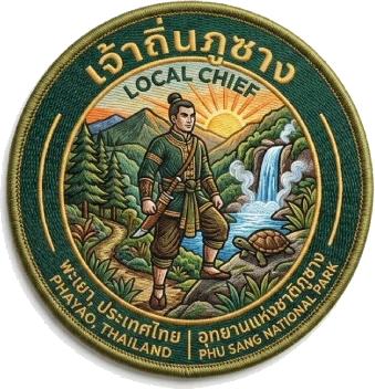
04 — Walk out and collect for real
Walk to the real coordinates
then raise your camera and collect
Every place has a real pin with its own radius. Step inside it, open the camera and tap the coin floating in front of you to earn points and stamp your passport.
05 — Already planned for you
Routes laid out for you to follow

One Day Along the Warm Water
Start at the information centre, climb to the stupa, and finish by soaking your feet in the warm waterfall

The Border and the Stars
Morning at the two-nation market, afternoon at the far edge of the border, night counting stars on the ridge

Deep Caves, Big Forest
A limestone cave route inside the national park — a ranger guide must be booked in advance
06 — Phu Sang calendar